
A human-centered design consultancy that collaborates with clients & users to be more focused, adaptive & competitive.
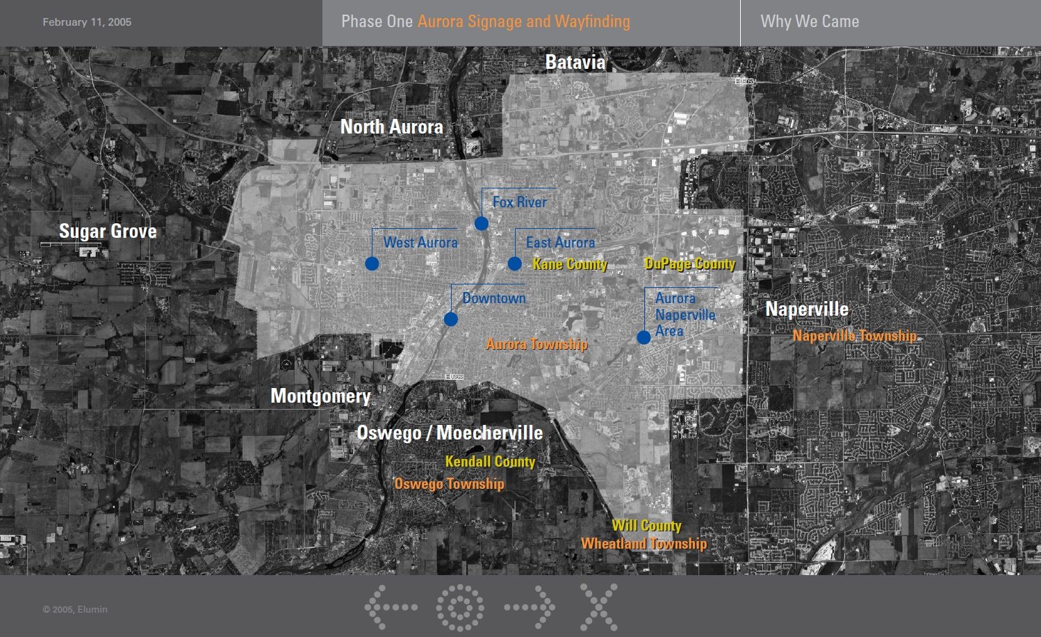
Geography of Aurora, IL
Aurora is a western suburb that covers 32 square miles with major arterial roads driven by a major highway and includes both incorporated and unincorporated areas. This map shows the complexity of wayfinding in all directions.
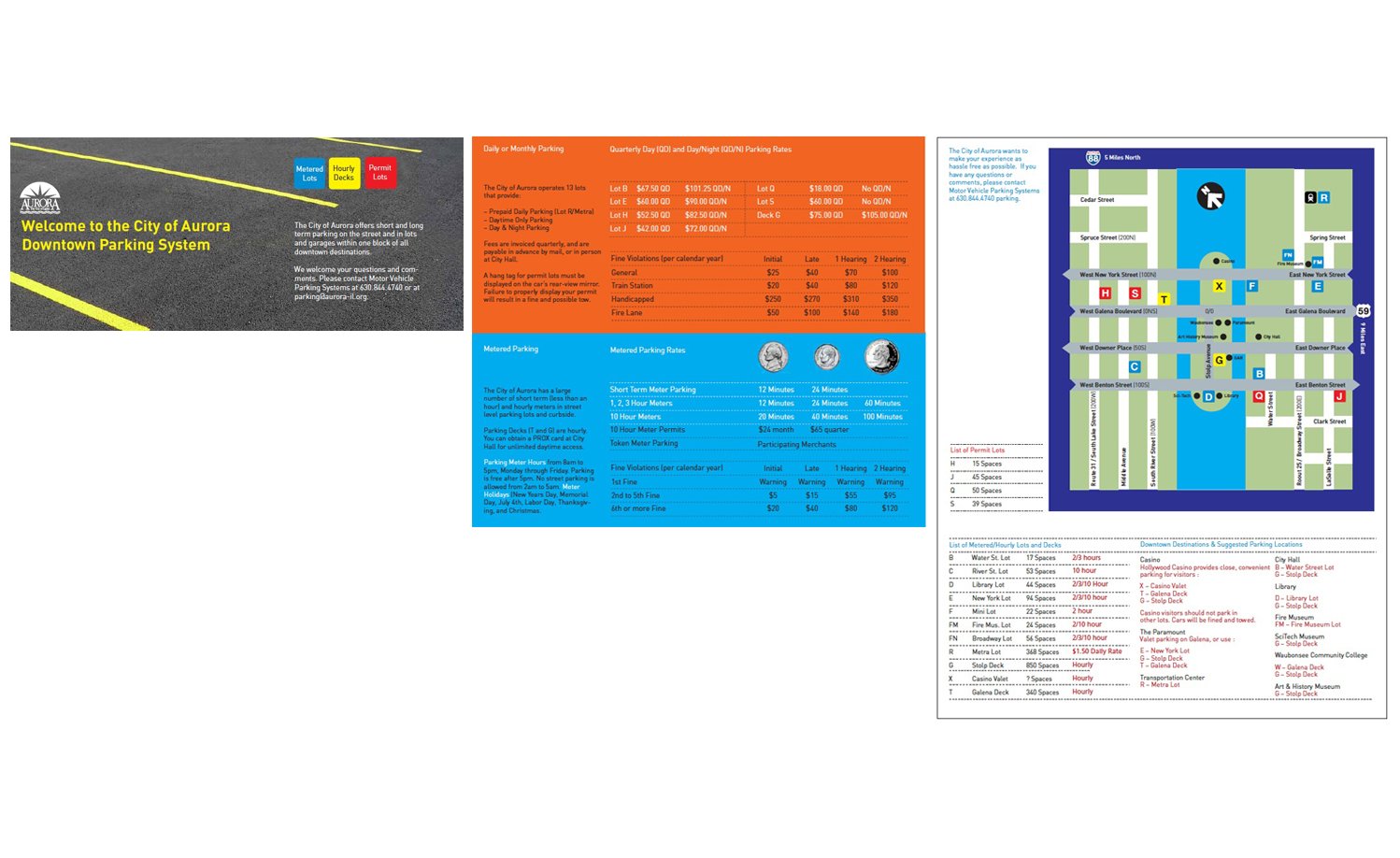
New Parking Brochure
Aurora wanted to maximize usage of its municipal parking facilities, so Trope Collaborative came up with a new parking brochure that highlighted where all municipal lots were located and which were metered, hourly and permit.
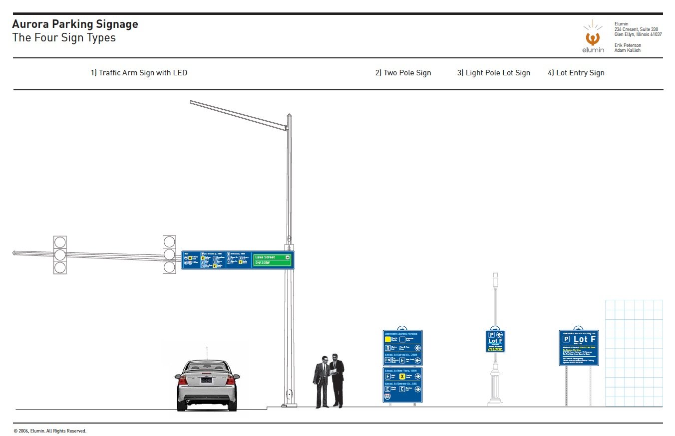
A Simple Signage System
Based on the production capabilities of the Aurora Streets and Sanitation Department, Trope Collaborative created four key sign types that all way finding messages could be applied to.
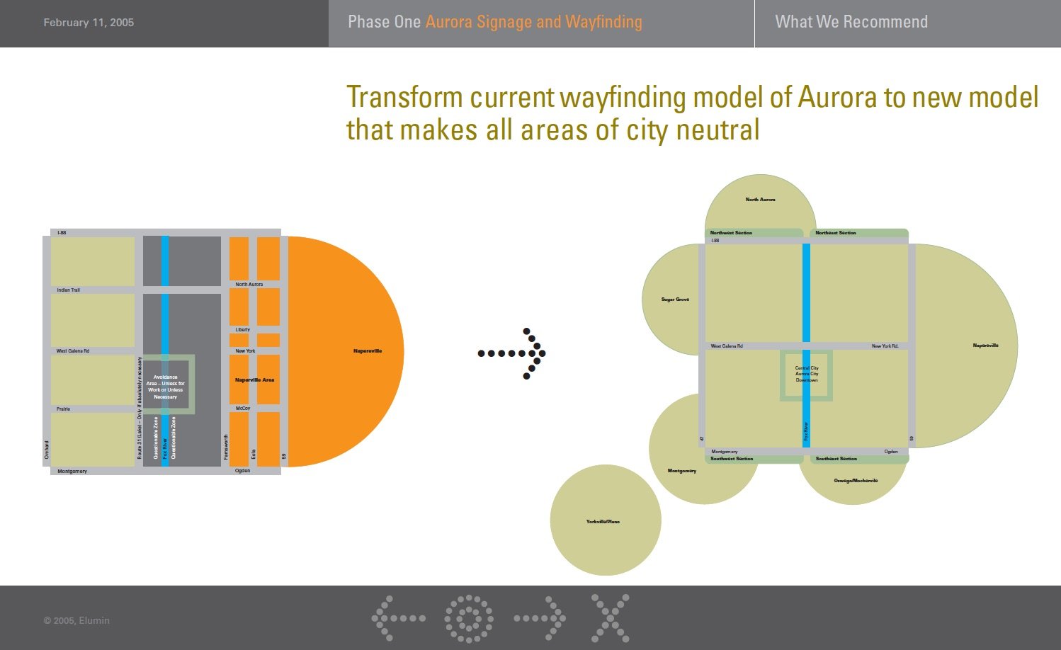
Tranforming from Where Not To Go, to a Series Of Neighborhoods
Based on all the research, Trope Collaborative was able to show the "as is" state of people"s perception of Aurora and then propose a "to be" state based on key neighborhoods and geographical desitinations.

Proposed Signage
Based on all the research, I identified where new or replacement signage would be placed and the message for each sign.

Identifying key Aurora assets
Based on a workshop and surveys, Trope Collaborative identified key destinations, landmarks and services in 12 categories. These were weighted by how frequent people visited these places which helped define way finding messaging.

Engaging the Community With 'Where Is That?'
Trope Collaborative identified key destinations, landmarks and services and asked participants to place a dot where they thought the location was. In most instances, people were off thousands of feet, and even miles. This helped us understand the knowledge of Aurora citizens of their town.

What Affects a Sign?
A single sign is affected by a fabric of state, regional and local agencies as well as City of Aurora committees and non-governmental organizations.

Understanding Traffic Flows
Since Aurora is so reliant on automobiles through arterial roads, Trope Collaborative received the average daily traffic counts for major arterial roads which would impact where wayfinding signs and messages would be placed.